
Cities transformed: then/now aerial photos
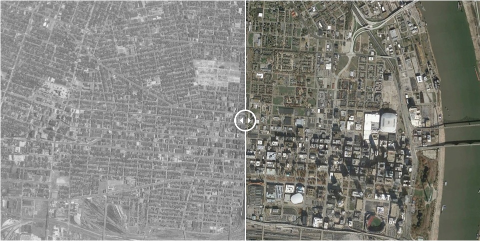
60 Years of Urban Change: Midwest – striking before and after aerial photos of nine midwestern cities show the profound effect highways and other land clearance projects of the mid-1950s have had in changing the texture of these downtowns over the last 50 years. The Institute of Quality Communities at The University of Oklahoma has formatted these aerials into sliders; you slide the center bar to the right or left to see just how much has changed. If they take a few moments to load, be patient because they’re fascinating, well worth the wait. These are rust belt cities, former industrial centers – most built on rivers – that experienced serious population and economic decline over the time period illustrated. Shown here is St. Louis; the other cities are Cincinnati, Detroit, Kansas City, Minneapolis, Milwaukee, Indianapolis, Cleveland, and Columbus.
The post links to more “then-and-now sliders”, one for cities in the Southeast and one for cities in Oklahoma and Texas.
With thanks to a post by Tamara Bozovic on the LinkedIn Group, Urban Planning Group.